
Bay Area Weather & Creeks
High Tides Flood Corte Madera as Valley Water Preps Creeks
The National Weather Service extended its coastal flood advisory through Friday at 5 p.m., while Valley Water detailed sediment and bank work across five San Jose waterways.
Your listening Queue & catch up
Add a story or build a catch-up queue to start listening.
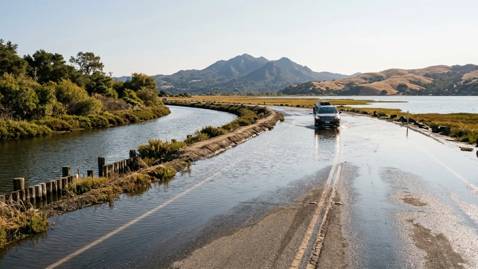
High tides around 1 p.m. Tuesday flooded low-lying roads in Marin County—turning a Corte Madera neighborhood near The Cove School into an island and blocking Golden Hind Passage Road—as the National Weather Service extended a coastal flood advisory through Friday at 5 p.m. for bayshore areas along San Pablo Bay, San Francisco Bay, and Monterey Bay, according to KTVU FOX 2. Across the region on Tuesday, San José Spotlight and Claycord highlighted pre-winter El Niño flood preparations, while NBC Bay Area reported a preliminary 2.6 magnitude afternoon earthquake near San Jose.
Corte Madera High-Tide Flooding and $10,000 Business Flood Barriers
In Corte Madera, salty bay water trapped several vehicles, halted delivery trucks, and prompted residents to stack sandbags outside their homes Tuesday afternoon. The Marin County Office of Emergency Management urged drivers to stay off flooded roadways, with even higher tides forecast for Wednesday.
Sachi Itagaki, a member of the Corte Madera Flood Control Committee who raised her home several years ago, told KTVU that neighbors are seeking longer-term infrastructure solutions: “Any water is going to work its way. Any tiny crevice is going to get through.” Across Highway 101, Fitness SF manager Ryan Davis said the gym invested $10,000 in orange flood barriers after last January’s flooding sent water inside the building, and urged local officials to close flooded streets earlier so passing vehicles do not push wakes into nearby businesses.
Both the California Office of Emergency Services and Claycord reminded drivers across California to prepare for approaching El Niño storm conditions by checking Caltrans QuickMap, slowing down, turning on headlights whenever windshield wipers are in use, and never driving across flooded roads.
Valley Water Completes June–October Maintenance on San Jose Creeks
In the South Bay, Valley Water District 4 Director Jim Beall outlined the agency’s annual June-through-October Stream Maintenance Program in San José Spotlight, funded in part by the voter-approved Safe, Clean Water and Natural Flood Protection Program. Of Santa Clara County’s more than 800 miles of creeks, Valley Water owns or manages roughly 350 miles in urbanized valley areas.
To prepare for potential heavy El Niño rains, crews completed four categories of work—bank protection, sediment removal, vegetation management, and native riparian planting—across five District 4 and adjacent waterways:
- Ross Creek: Excavators and compact track loaders removed sediment buildup near Meridian, Jarvis, and Cherry avenues, while crews completed bank erosion repairs downstream of Sandy Lane and downstream of Camino Del Cerro.
- San Tomas Aquino Creek: Sediment removal downstream of Pollard Avenue to restore channel capacity.
- Alamitos Creek, Alamitos Diversion Channel, and Los Gatos Creek: In-stream and creekside vegetation management, lower tree limb pruning, and invasive plant removal upstream of Mazzone Drive along Alamitos Creek and the Alamitos Diversion Channel, alongside maintenance on Los Gatos Creek.
Preliminary 2.6 Magnitude Earthquake Recorded East of San Jose
Separately on Tuesday afternoon, the U.S. Geological Survey recorded a preliminary 2.6 magnitude earthquake at 12:38 p.m. near San Jose, according to NBC Bay Area. The USGS reported the quake was centered 9 miles east of Seven Trees, 9 miles east-southeast of Alum Rock, and 9.8 miles east of Communications Hill.
Sources
Comments (0)
No comments yet. Be the first to share a thought on this story.